

3D Laser Scanning – Accurate 3D Surveying of Buildings and Spaces
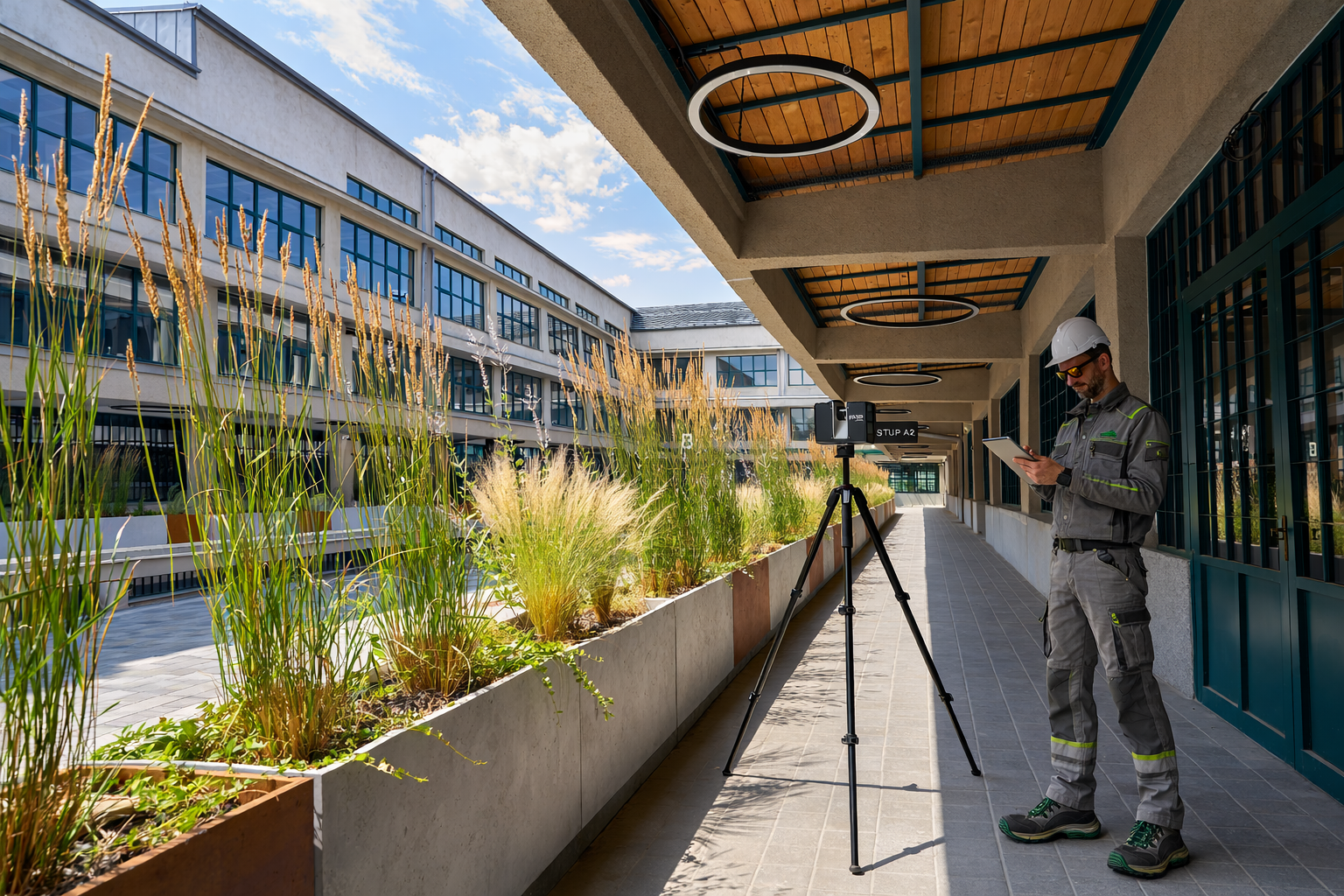
We carry out measuring work of any complexity at production facilities using terrestrial laser scanning
What is Laser Scanning?
3D laser scanning is a contactless measurement technology in which a laser scanner (or LiDAR) captures the coordinates of a large number of points on an object's surface, creating its precise digital model (point cloud). This method ensures high accuracy and detailed visualization of objects for analysis, design, and inspection. It is an ideal solution for precise, fast, and safe measurement of buildings and spaces.
Laser scanning saves time and costs by reducing the need for repeated site visits. The captured data can also be re-analysed or processed at any time as project requirements evolve.
If you are looking for reliable and accurate laser scanning in Prague and the surrounding area, contact us. We provide end-to-end services—from scanning and data processing to the delivery of finished drawings and 3D models tailored to your needs.
Laser scanning results
-
Point Cloud
A laser scanning point cloud (point cloud) in any required format (e57, rcp, xyz, las, etc.) for use in CAD software

-
2d Drawings
Detailed 2D floor plans with room dimensions, floor and ceiling heights. Includes longitudinal and cross-sections, etc.

-
3D Models
Detailed 3D models of buildings and interiors, including utility networks.
High-level detail and accuracy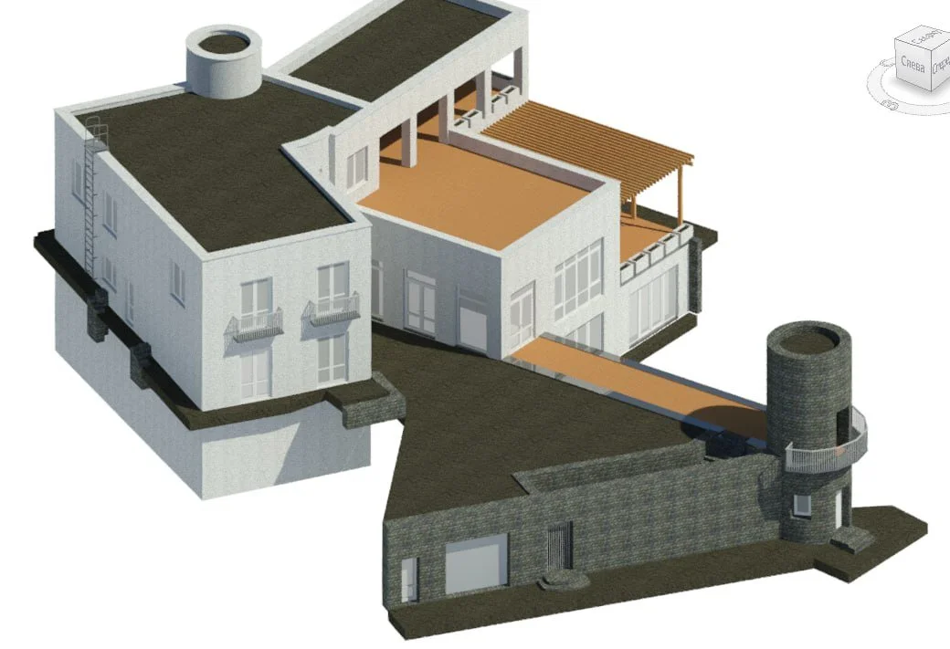
-
Building passport
Get a simplified building passport with clear documentation – fast and cost-effective

-
Facade drawings
Comprehensive drawings for restoration projects and cultural heritage preservation.

-
3D terrain model
Digital Terrain Model (DTM) or Digital Elevation Model (DEM) created on the basis of laser scanning results

Advantages of Laser Scanning
High Accuracy – Laser scanning enables the acquisition of highly detailed and precise data with millimeter accuracy.
Fast Data Collection – The technology allows for large-scale measurements in a short time, significantly speeding up data collection compared to traditional methods.
Non-Contact Method – Measurements are conducted without physical contact with the object, making it ideal for historical buildings, hazardous environments, or hard-to-reach areas.
Comprehensive 3D Data – The output is a point cloud that provides a detailed digital 3D model of the object, suitable for further analysis and processing.
As-Built Documentation – Laser scanning captures the exact state of an object at a given moment, which is invaluable for renovations, restorations, and construction projects.
Repeatable Analysis – The point cloud can be archived and revisited later for additional measurements or to track changes over time.
Seamless Integration with CAD/BIM – The scanned data can be easily converted into formats compatible with ArchiCAD, Revit, AutoCAD, and other software solutions.


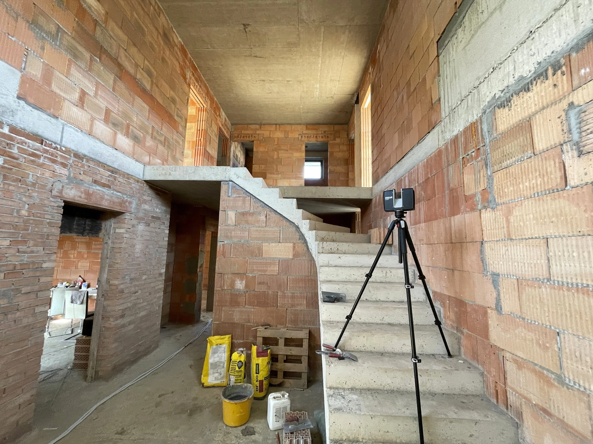
Experienced specialists will measure hard-to-reach areas of buildings and structures, which are difficult to measure by standard methods for any reason. The use of terrestrial laser scanning in measurement work is suitable for industrial enterprises during their modernization in the absence of an original documentation and drawings.
We will help to determine the actual dimensions and position of building structures and equipment, embed the measurement results in 3D model of the object. The technology allows us to solve the integrating new technological equipment into existing production in the fastest way. Laser scanning in Prague, Czech Republic, and all over Europe.
Our Advantages
Fast and accurate 3D measurements without disrupting operations
1
Experienced specialists with more than 10 years of practice in the field
2
Even hard-to-reach areas of buildings can be surveyed with precision
3
Support for working with laser scanning data at every stage of the project
4
We use laser scanning in:
Measuring of civil or industrial sites
Dimension control of a newly built objects according to their project parameters
Determination of geometrical characteristics of existing pipelines and networks
Calculation of surface areas and volumes of ground
As the result you will get:
Point cloud in color with panoramic view mode
Precise 3D model of a scanned object
Drawings of any part of scanned building: 2d floor plans, facades, roof, cross sections etc.
Report about surface area or volume of measured object