3D laser scanning of facades and terrain for BIM model, Aquapalace Praha
Accurate surveying of a building and the surrounding terrain using 3D laser scanning
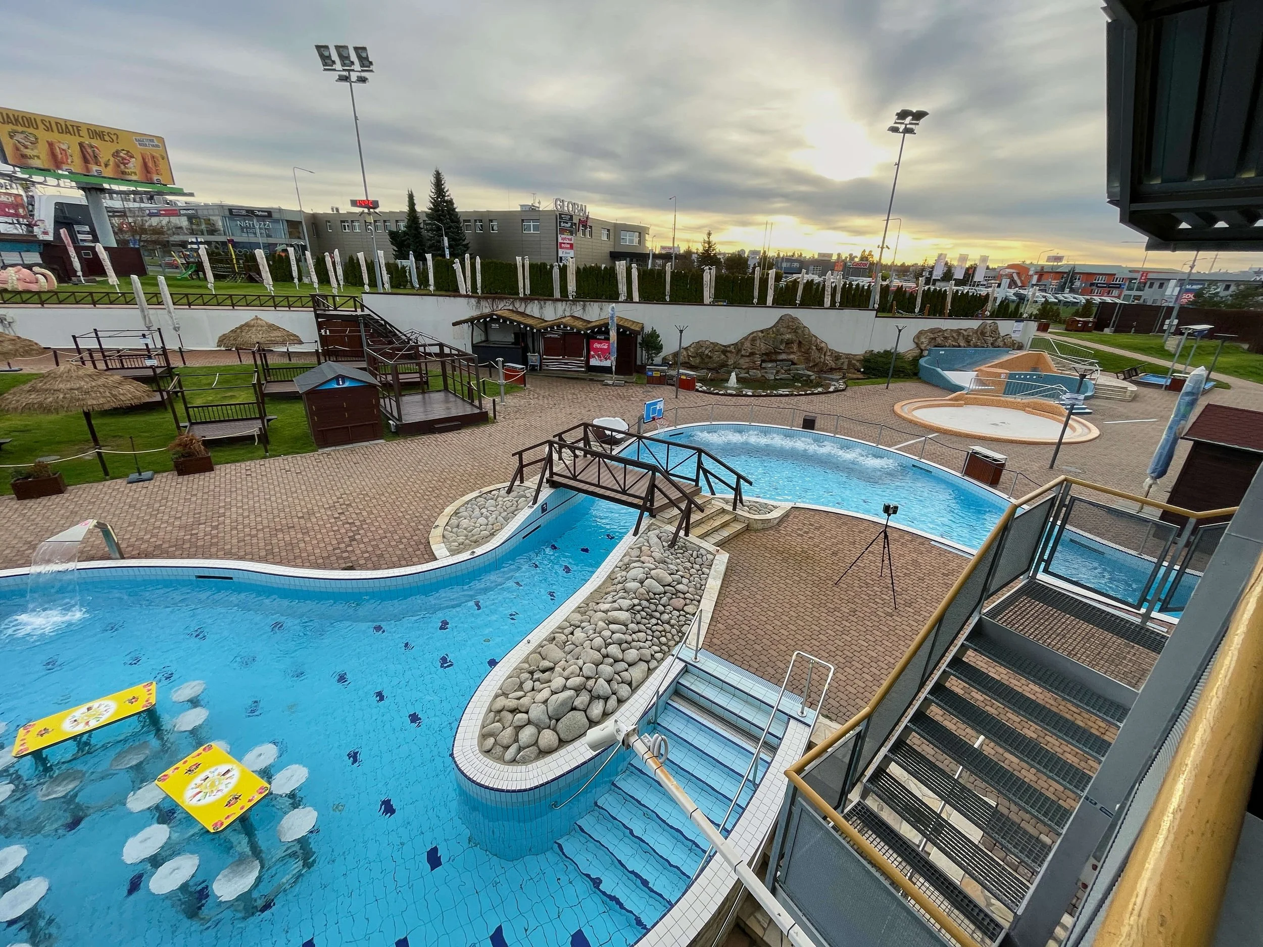
At the end of 2025, shortly before the Christmas holidays, we carried out an interesting 3D survey of part of the Aquapalace Prague building and the surrounding area. The main goal of the project was to create an accurate basis for BIM modeling for the renovation of the facility.
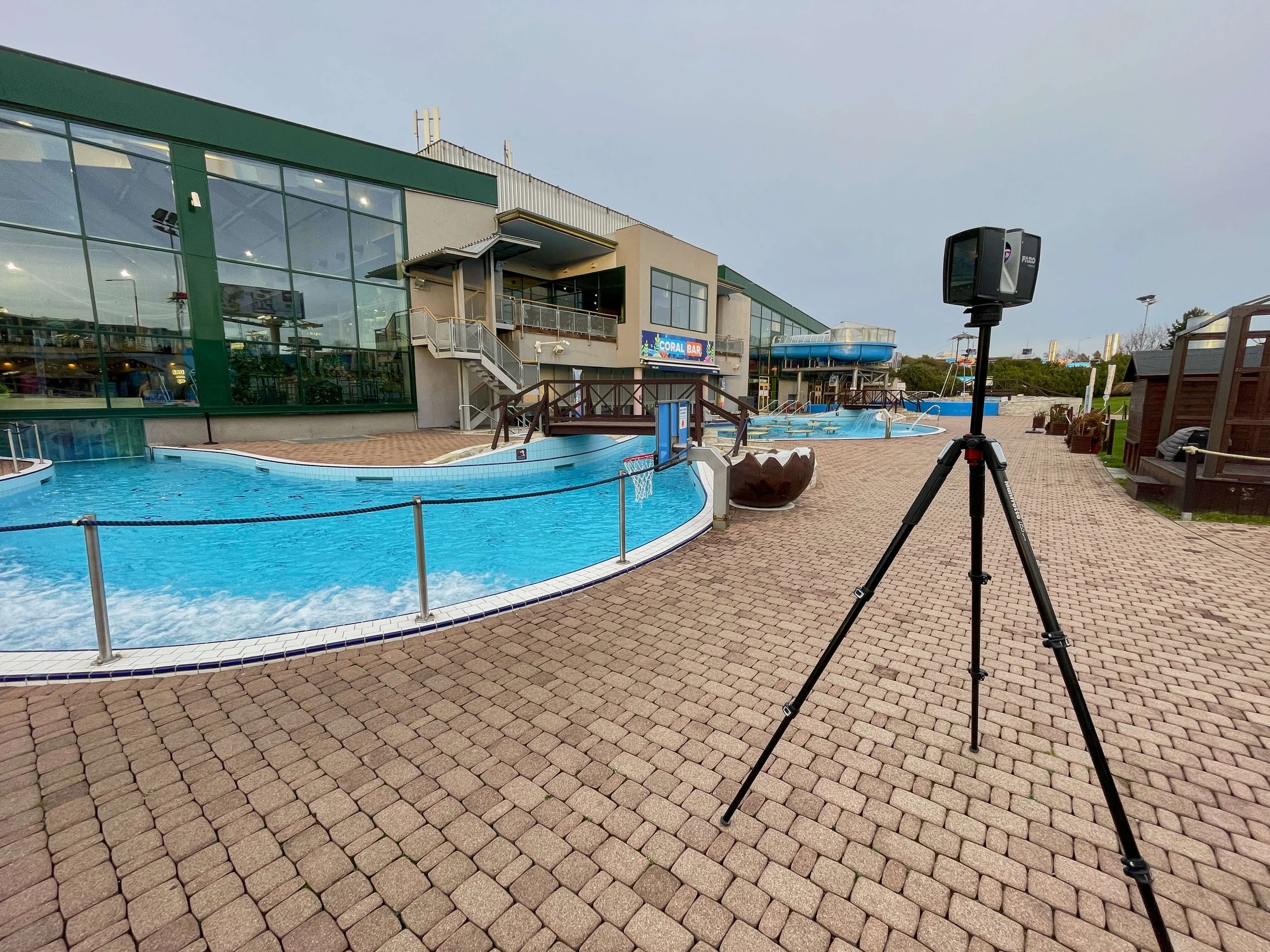
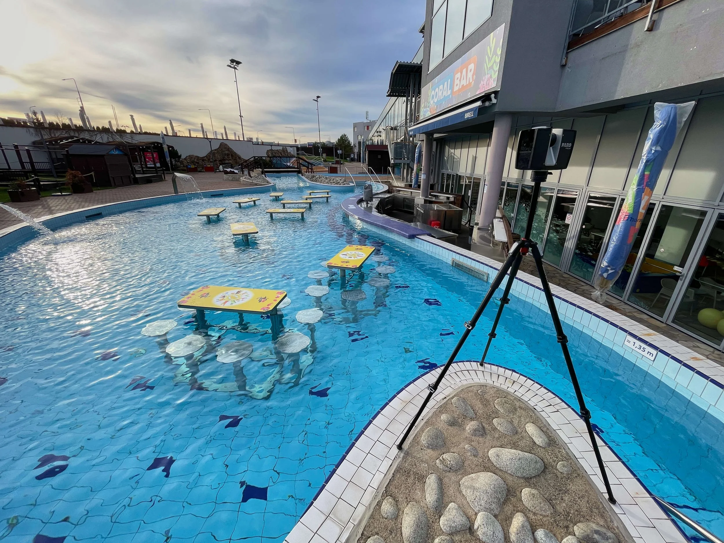
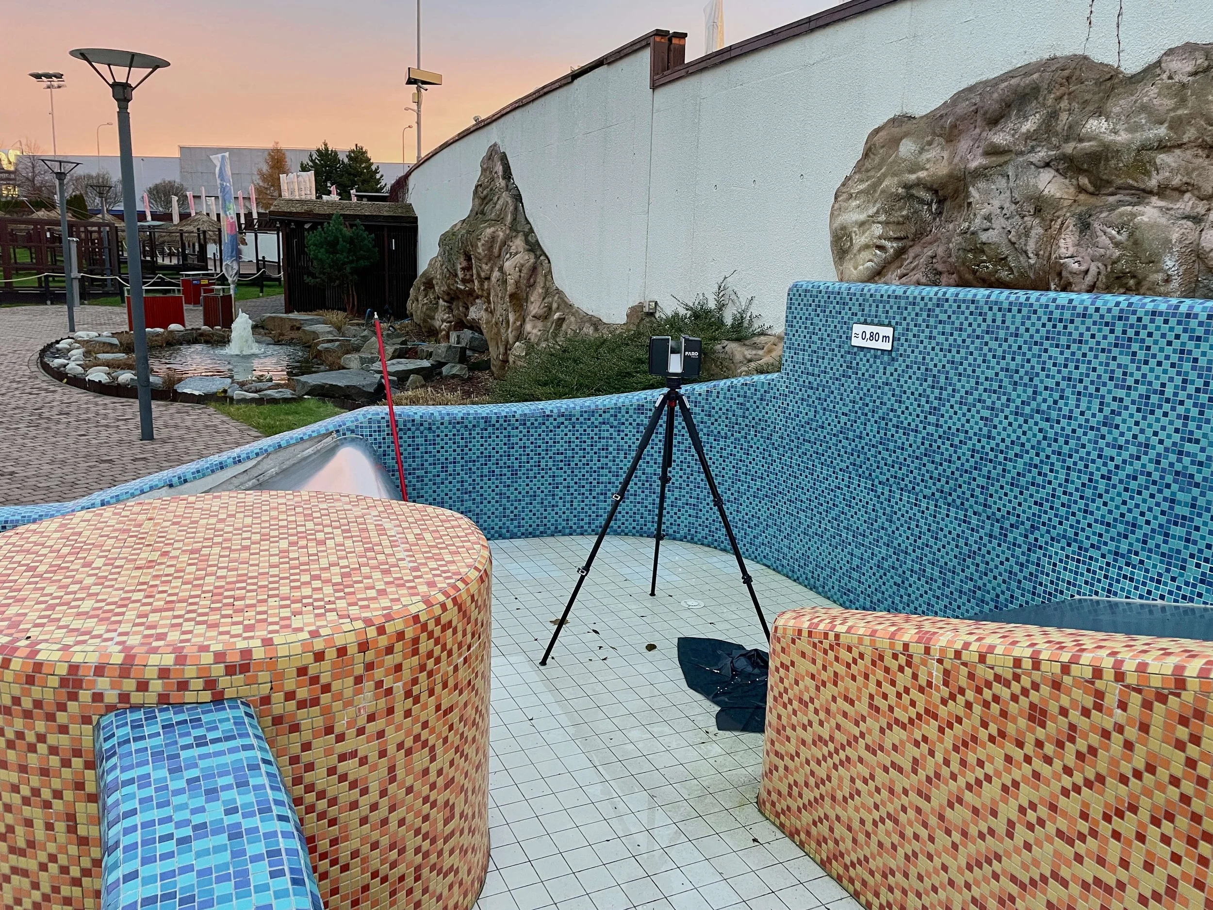
The task was to survey and then create a 3D BIM model of the bar area with pools, the building façades on the southwest side, the adjacent SPA zone, and the surrounding terrain with its relief. For the survey, we used a FARO Premium terrestrial laser scanner, which enables very accurate capture of the as-built condition of structural elements as well as the shape of the terrain. The laser scanning of the site and its surroundings was completed within one working day. The total number of scan positions was 120.
Point cloud processing from laser scanning
Individual scan positions were merged into a single point cloud within a unified coordinate system. The data then underwent detailed processing, including removal of noise, moving people, and other unwanted objects.
The resulting high-density point cloud was further optimized and automatically classified into individual object categories:
ground surface
vegetation
tall vegetation
buildings
other environmental elements
This classification significantly facilitated the subsequent 3D modeling of structural elements and terrain.
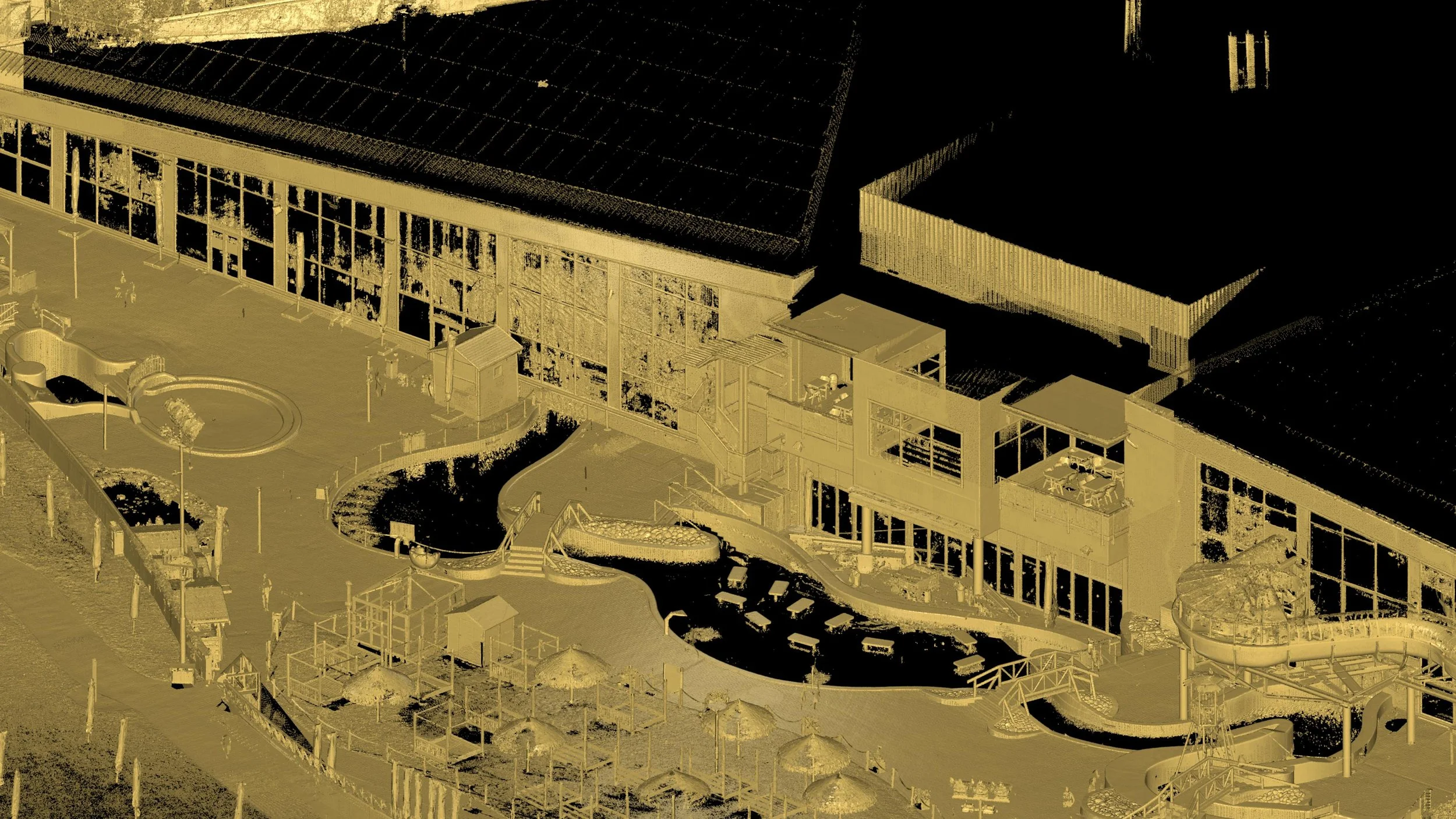
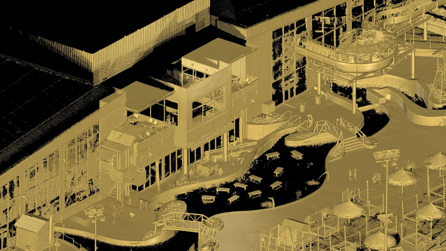
Visualization of a dense point cloud from terrestrial laser scanning of the as-built condition
Point cloud intensity visualization – façade and outdoor area
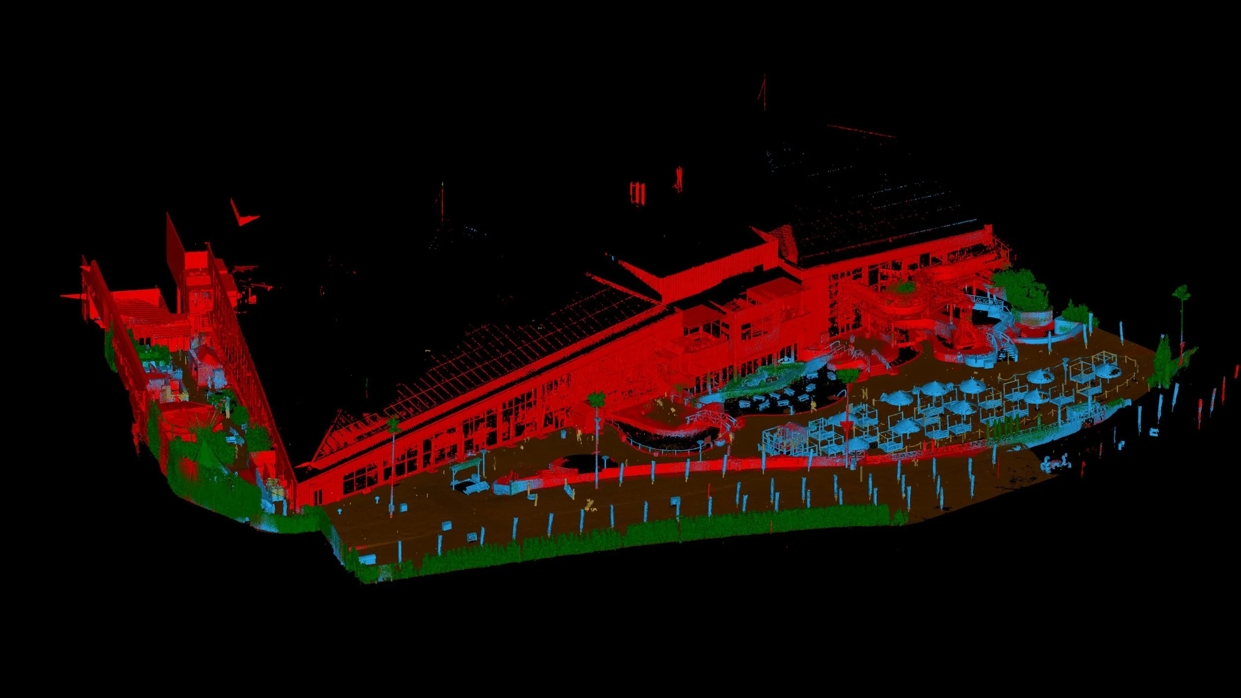
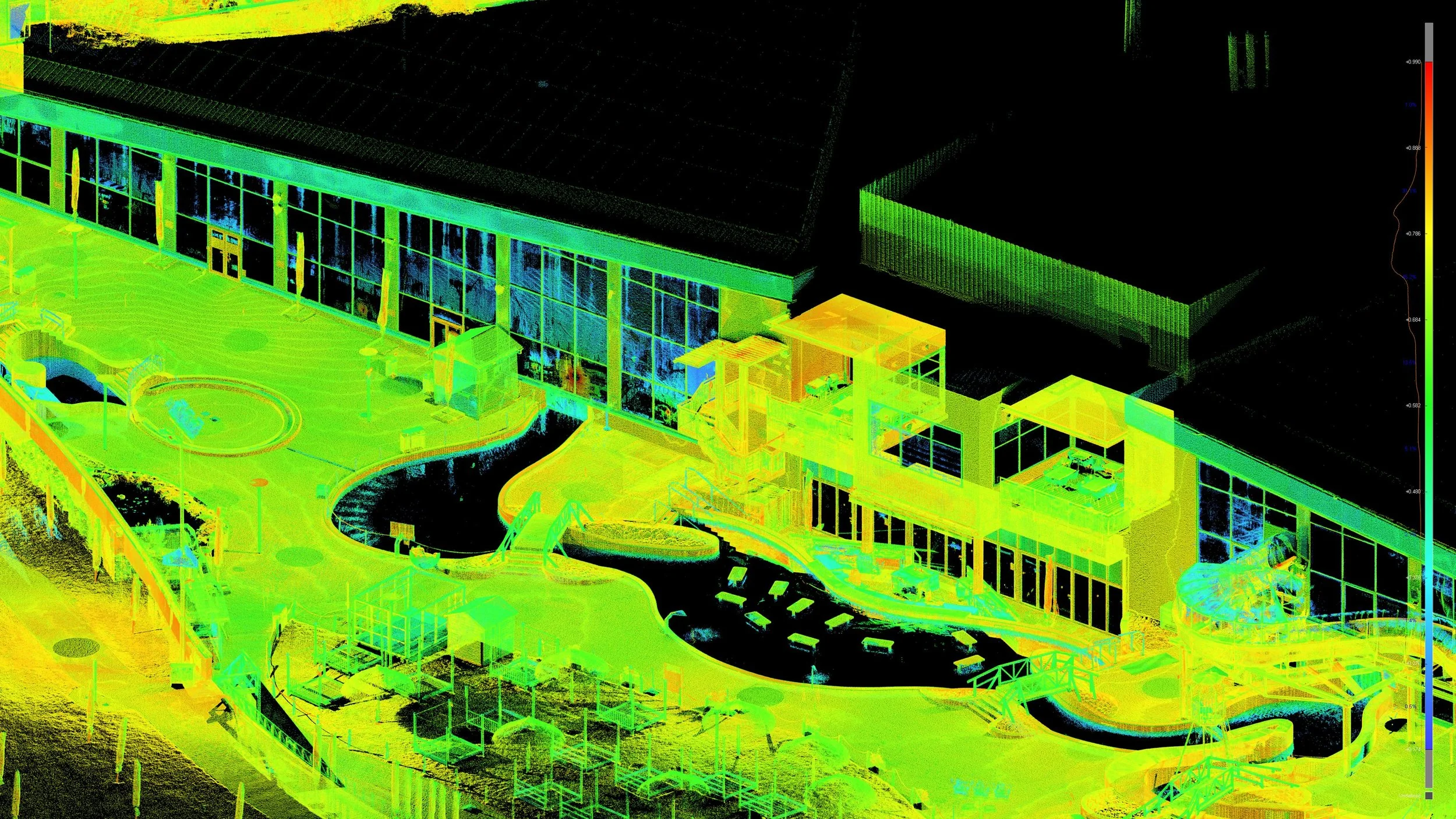
Classified point cloud – façade and outdoor area
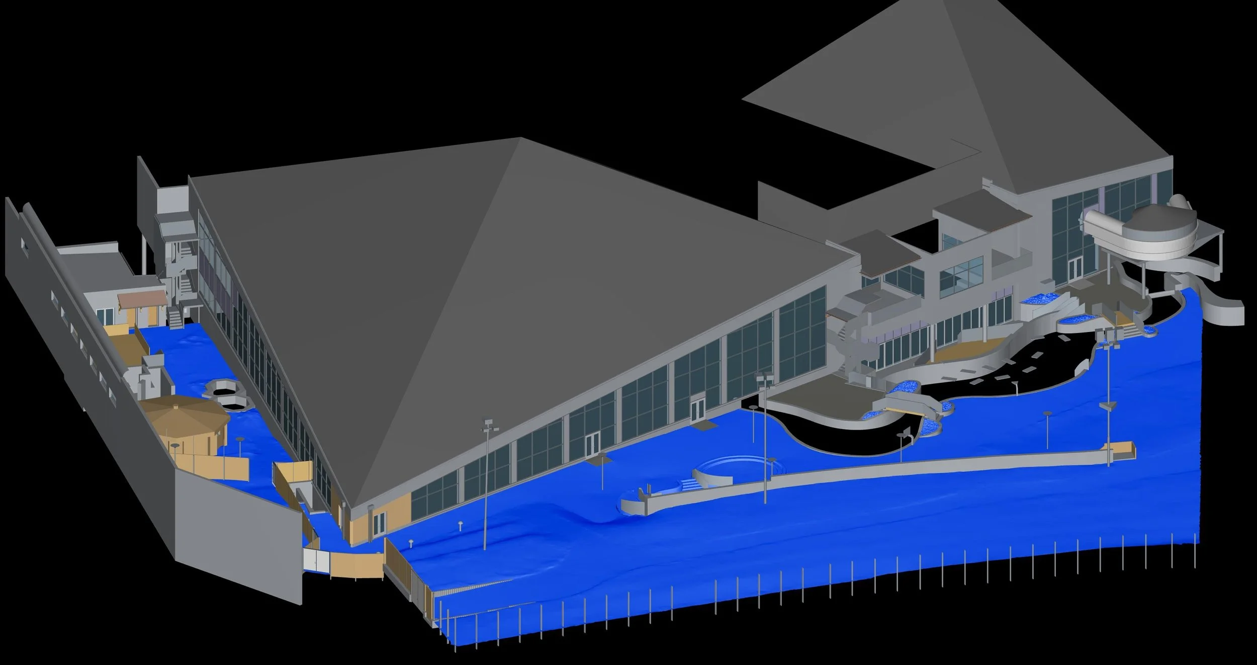
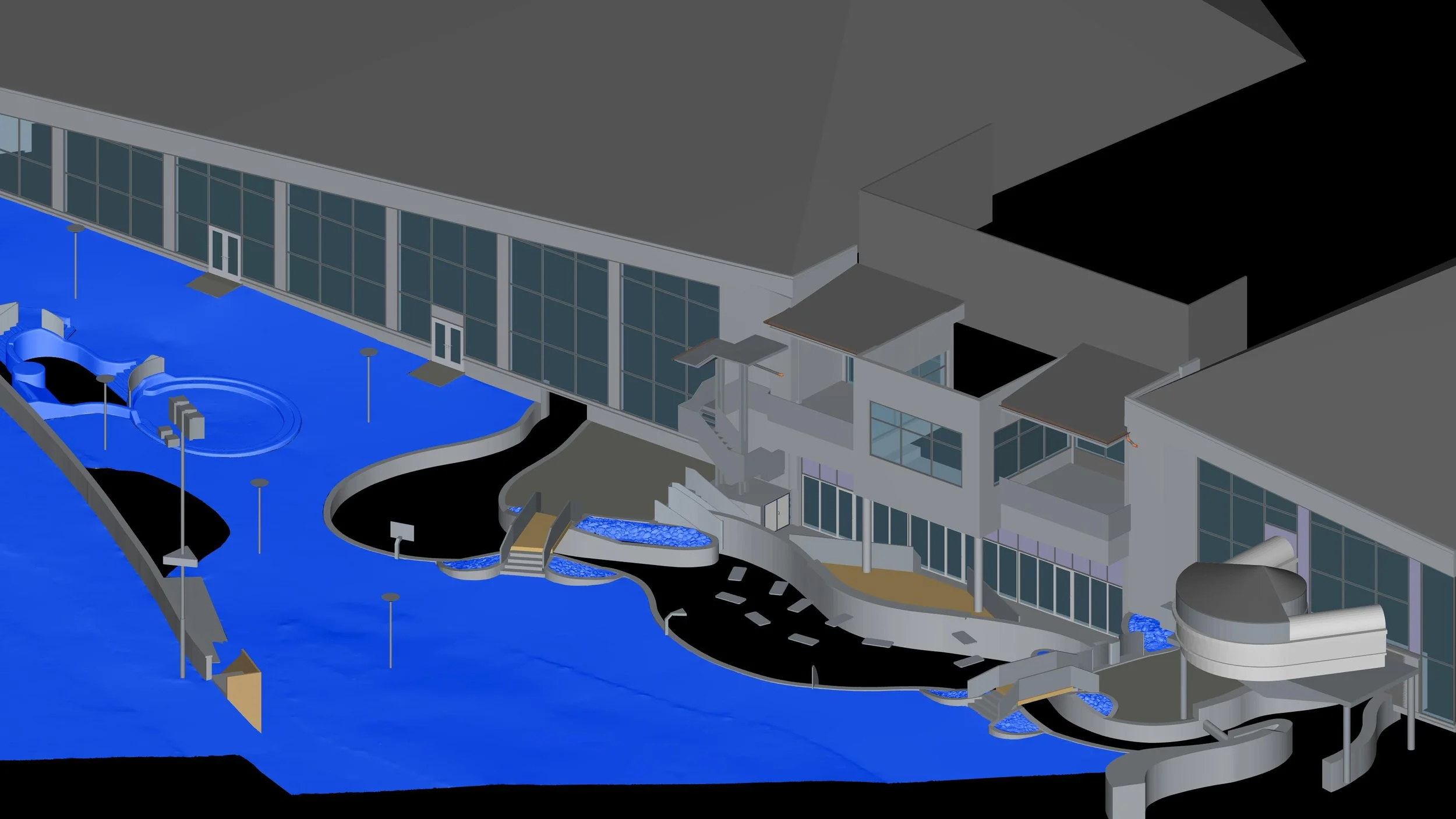
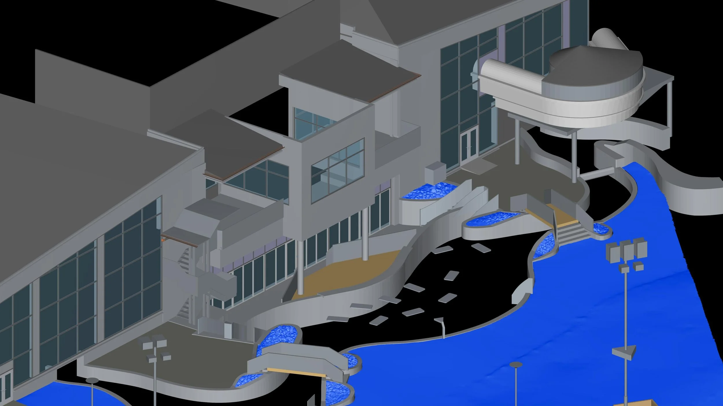
Terrain and structural modeling
To achieve maximum accuracy, the terrain relief was modeled using a mesh network optimized to preserve detail in complex areas while minimizing the final model size.
The resulting terrain model was then converted into a CAD object that accurately matches the real terrain geometry.
The building and structural model was created in a Building Information Modeling (BIM) environment at LOD 250.
The final 3D BIM model was then combined with the terrain model and exported to the required formats:
DWG
STP
IFC

Project results
The total project processing time—including point cloud registration, data processing, and creation of the 3D model—was 9 working days.
The resulting model provides the client with an accurate digital basis for renovation design, architectural proposals, and further planning of construction modifications.
We approach every project with a strong focus on measurement accuracy, high-quality deliverables, and meeting agreed deadlines.
We are satisfied with the outcome—and most importantly, our clients are satisfied as well, which we consider the best confirmation of the quality of our services.